Beam Rolls Out Surface Detecting Scooters
Adelaide, SA
Share service provider Beam continues to roll out innovations to its services in several Australian cities, unveiling new AI Pedestrian Shield technology that automatically adjusts scooter speeds and an integration with Google Maps to help users find a Beam vehicle.
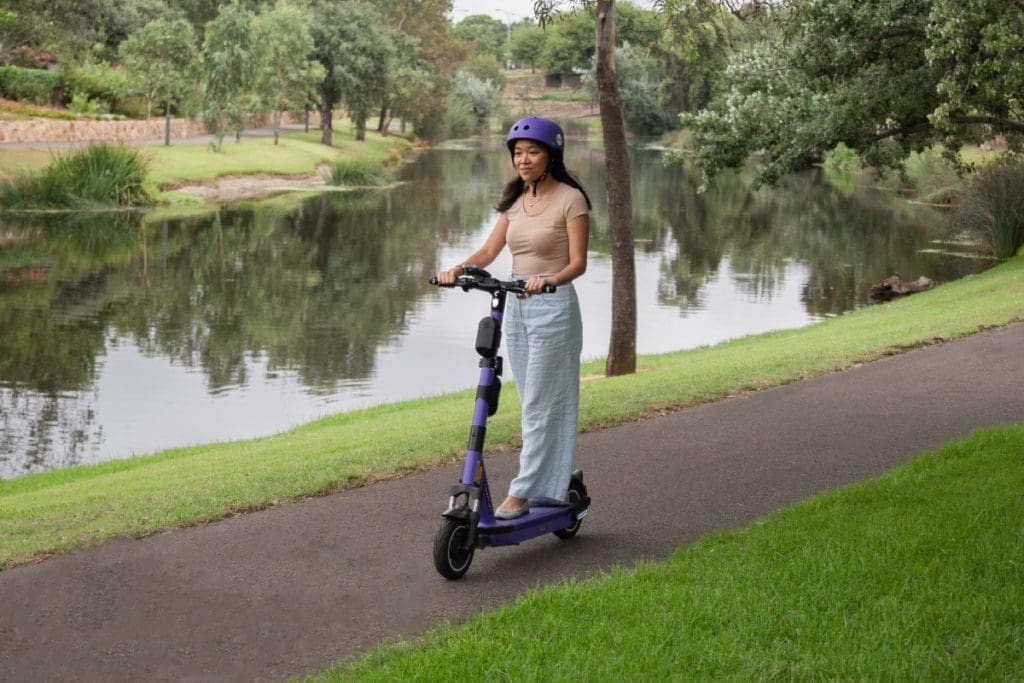
In mid-March, Beam started introducing Pedestrian Shield to its services in Brisbane, Adelaide, Canberra, Hobart, Launceston and Perth, enabling scooters to detect different road surfaces and automatically adjust the vehicle’s maximum speed accordingly.
The trial, a first for the Asia-Pacific region, is being implemented in partnership with Los Angeles-based company Drover AI, which has developed an IoT module capable of distinguishing between different types of infrastructure.
The PathPilot module, designed for micromobility vehicles, can accurately and reliably identify sidewalks, streets and bike lanes without the need for ground truth information or precise GPS.
“Pedestrian Shield uses an on-board camera that detects when riders are riding on pavements instantly and accurately without the need for precise mapping and perfect positioning“
Beam Group’s Chief Technology Officer, Deb Gangopadhyay, said: “The majority of pavement detection technology relies on positioning like GPS and detailed mapping of every road and pavement in a city
“These solutions are not scalable and are unreliable due to the proximity of roads and pavements within a single meter.
“In comparison, Pedestrian Shield uses an on-board camera that detects when riders are riding on pavements instantly and accurately without the need for precise mapping and perfect positioning.”
Greater Reassurance for Councils
A statement by Beam said Pedestrian Shield would help accelerate the roll-out of e-rideables nationwide, by giving cities greater control of speeds and riding rules for share scooters and e-bikes in their areas.
Beam’s ANZ General Manager, Tom Cooper, said: “With different States in Australia having different legislation governing e-rideables, Beam’s Pedestrian Shield will be able to adapt to the different riding rules in each State – whether that is to enforce lower speeds on footpaths, or stopping the Beam altogether.
“It will educate riders on safe riding around the cities, providing in-trip and post-trip feedback.
“Beam’s goal is to level up the entire industry and encourage this safety technology to be the standard that councils and governments demand.”
A second phase of Pedestrian Shield’s introduction will be implemented in mid-2022, adding technology to enable Beam scooters to detect pedestrians on footpaths and to slow automatically to prevent a collision.
Google Maps Integration
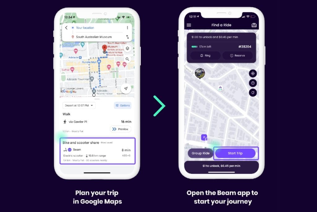
Beam last week announced it has integrated its services with Google Maps in Australia and NZ, bringing further connectivity for its users.
Google Maps can show the location of available Beam e-scooters and e-bikes, as well as the rider’s distance from that vehicle, the estimated time of arrival at the destination, estimated price and battery life of the vehicle.
When a vehicle is selected on the map, the user is directed to Beam’s app to start a trip.
The integration will be available in many cities where Beam operates, including Brisbane, Townsville, Port Douglas, Adelaide, Canberra, Sydney, Perth, Esperance, Bunbury, Hobart and Launceston.
It will also cover Beam’s entire NZ footprint, comprising Auckland, Wellington, Whangarei and Palmerston North.